Discover Civita di Bagnoregio: Etruscan history, medieval architecture, the famous bridge and the spectacular Valle dei Calanchi.
A village perched on a fragile cliff, a narrow bridge connecting it to the present, and a landscape shaped by centuries of erosion. Civita di Bagnoregio in northern Lazio is a remarkable meeting point between architecture and geology. Its silhouette above the Valle dei Calanchi is instantly recognisable, yet the real story extends far beyond the postcard image.
Known as the dying town, Civita is also a place of remarkable resilience. Building here has always meant adapting to unstable ground, reinventing access routes and protecting an architectural heritage whose setting never stops changing.
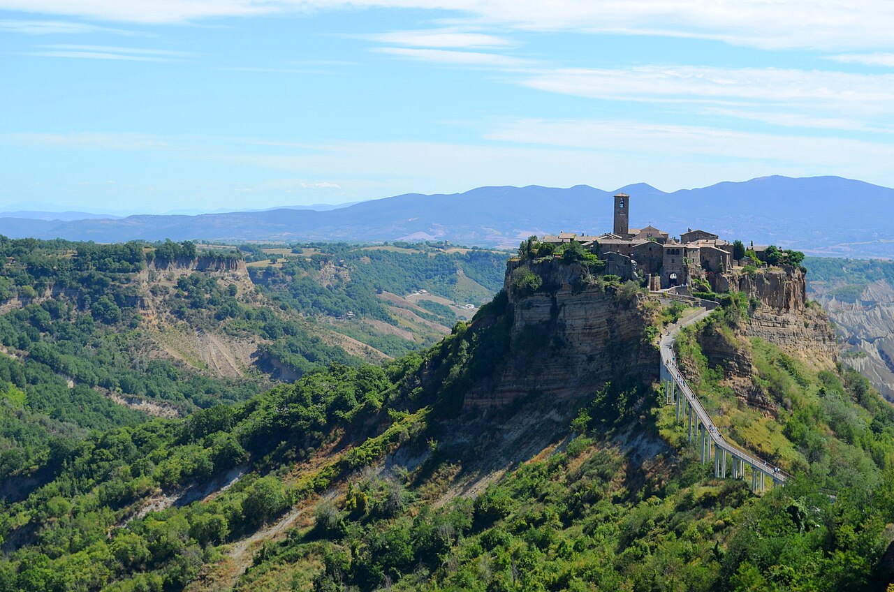
Where is Civita di Bagnoregio?
Near Lake Bolsena, in the province of Viterbo, Civita stands on a volcanic tuff plateau over softer clay formations. Around it, the Valle dei Calanchi unfolds in ridges, deep gullies and sculptural slopes. When mist rises, the village seems to float above the landscape; at sunset its stone buildings glow amber. Yet this extraordinary environment is still being transformed by water and erosion.
Why is Civita called the dying town?
The nickname refers to cliff erosion, landslides and depopulation. Over the centuries, earthquakes and geological instability have destroyed buildings, historic routes and entire parts of the former settlement. The earthquake of 1695 marked a particularly difficult chapter. Civita once occupied a larger plateau than the one visible today.
The story, however, is not exclusively one of decline. Stabilisation works, improved access and conservation efforts have helped the village survive. Its challenge now is to balance preservation with the needs of residents and visitors, without turning the place into a mere scenic attraction.
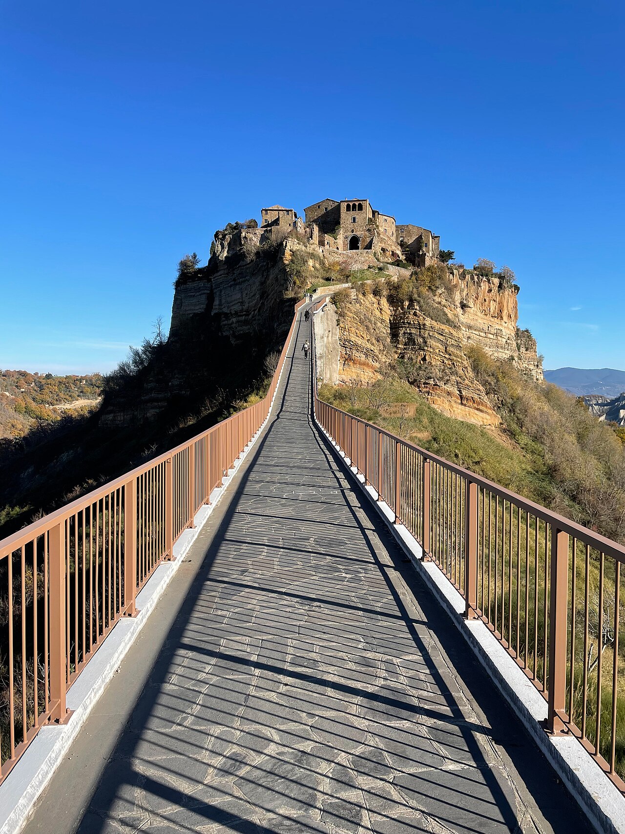
The bridge to Civita: a twentieth-century architectural landmark
Reaching Civita involves crossing a pedestrian bridge approximately 300 metres long. The present reinforced-concrete structure was inaugurated on 12 September 1965, after earlier connections had been damaged by landslides and wartime destruction. Its simple modern form does not imitate the medieval settlement: instead, it offers a clear architectural intervention in a changing landscape.
The bridge is now part of Civita’s visual identity. Walking above the ravine makes the village’s isolation tangible and transforms a practical journey into an encounter with the delicate balance between human ingenuity and natural forces.
2,500 years of architecture and history
The origins of Civita reach back to the Etruscan period. Roman, medieval and Renaissance transformations have left their traces in streets, walls and buildings. From afar, the village appears unified; up close, it reveals a complex accumulation of changing architectural languages and everyday adaptations.
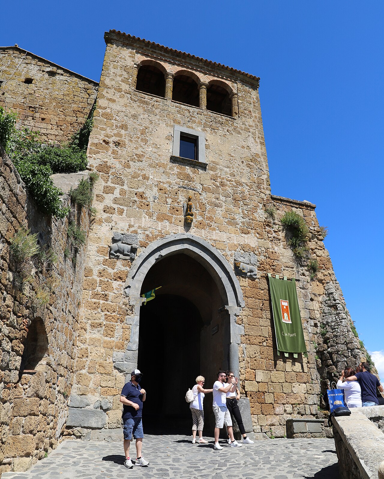
Porta Santa Maria, the surviving historic gateway
Porta Santa Maria is the only historic gate that survives. Originally carved into the tuff, it acquired its present monumental character through successive alterations. Stone reliefs showing lions holding human heads recall a fifteenth-century revolt against the Monaldeschi family. Entering through the gate is an encounter with the village’s layered history.
Piazza San Donato and the architecture of daily life
At the heart of the town, Piazza San Donato reveals Civita at a human scale. The church, weathered stone, modest doorways and narrow staircases tell the story of a settlement built to be inhabited rather than photographed. Winding streets follow the terrain and suddenly open towards the vast valley. Architecture here is both intimate and dramatic.
A cultural landscape worth protecting
Civita’s architectural value lies above all in the relationship between the village and the geological formation supporting it. Houses cluster along the cliff edge while masonry and natural rock seem to merge. Its cultural landscape appears on Italy’s UNESCO tentative list. This does not mean Civita has already been inscribed as a World Heritage Site.
Visiting Civita di Bagnoregio: what to see
Begin at a viewpoint in Bagnoregio to appreciate the entire composition of the bridge, village and ravine. Then walk to Porta Santa Maria, explore Piazza San Donato and take time to discover the quieter side streets. Entry is generally ticketed and the bridge is steep in places; consult official local information for updated arrangements.
The enduring power of a fragile place
Some destinations impress through what they have preserved. Civita is equally moving because of what it has lost. Its beauty does not arise from time standing still, but from generations finding ways to endure change. In this extraordinary village, architecture becomes an expression of memory, adaptation and care.
Frequently asked questions
Where is Civita di Bagnoregio located?
In the Lazio region of central Italy, near Lake Bolsena in the province of Viterbo.
Why is it called the dying town?
Because erosion, landslides and earthquakes have progressively reduced the village and contributed to depopulation.
How do you reach Civita?
On foot, along the approximately 300-metre pedestrian bridge.
Is Civita di Bagnoregio a UNESCO World Heritage Site?
No. It is on Italy’s tentative list, not the World Heritage List.